

https://geowiki.tistory.com/1768
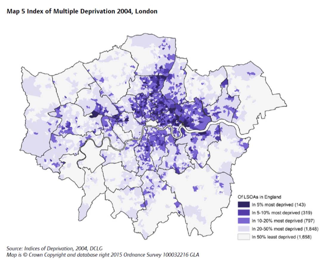
런던 구역별 주택가격과 공공 의료 상관 관계
지도출처 : Wikipedia This map shows the price of a square foot of housing in every postcode in London 출처 : https://www.citymetric.com/ 출처 : The Guardian - 2018.07.31
geowiki.tistory.com
(굵은 글씨 부분) 읽어보면 너무 당연한 건데
이걸 생각치 못하고 있었네
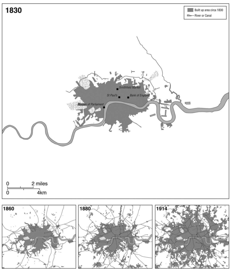
Recorded history along the Thames dates back to around 50 CE,
when the Roman Empire invaded the region and established the settlement of Londinium on the north bank of the river.
Londinium became the core financial area as the location was
ideal for trade. Invasions, plagues, and fire have since shaped this area over the past several centuries.
The Greater London area is comprised of 32 boroughs,
most of which are visible in this photo on both sides of the river.
The original city of London continues to be the epicenter of finance and business.
Westminster is the center of politics and governance,
a borough that includes the Houses of Parliament, the Prime Minister’s residence at 10 Downing Street, and Buckingham Palace.
Sections of the Thames have different historical and cultural significance.
One of the most notable is the difference between the east and west ends.
Since the river flows east toward the North Sea, most of the shipping
and heavy industrial districts developed downstream in the East End
where the river is deeper.
The West End contains more open spaces with parks and royal palaces.
Bridges are prevalent along the Thames, clustered near London and Westminster.
The first “London Bridge” was built by the Romans,
and many more were added to the landscape over time. Major landmarks in the mosaic
include Wembley Stadium, Hampstead Heath, Regent’s Park, Hyde Park, London Stadium (the 2012 Olympic venue), The O2, Greenwich Park, and the London City Airport.
런던 템즈강 원본 사진 (대용량) - 누르면 커져요

'주제별 자료 > 도시' 카테고리의 다른 글
| 코로나 시대의 세계 도시(Global cities) - '도시의 승리'에서 '도시의 살아남기'로 (0) | 2021.09.13 |
|---|---|
| 런던의 교외화 현상 (0) | 2021.08.23 |
| London Gentrification (0) | 2021.08.08 |
| 생산자 서비스업 탄생의 최소 요구치 (0) | 2021.06.24 |
| 자가용 보급과 도시의 확대 (0) | 2021.06.24 |